SEAS ARE PROVIDED AS A RANGE OF THE AVERAGE HEIGHT OF THE HIGHEST
1/3 OF THE SEAS...ALONG WITH THE OCCASIONAL HEIGHT OF THE AVERAGE
HIGHEST 1/10 OF THE SEAS.
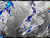
Synopsis...STRONG HIGH PRESSURE CENTERED OVER THE APPALACHIANS WILL SINK
SOUTHWARD OVER OUR REGION TONIGHT THROUGH WEDNESDAY WHILE GRADUALLY
WEAKENING. ONSHORE WINDS AND HAZARDOUS SEAS WILL ONLY GRADUALLY
SUBSIDE TODAY. HIGH PRESSURE WILL RESIDE OVER SOUTH FLORIDA LATE
THIS WEEK...WITH STRENGTHENING OFFSHORE WINDS EXPECTED.
Rest Of Today...East to northeast winds 15 to 20 knots. Seas 4 to 6 feet with occasional seas up to 8 feet. Inland waters a moderate chop. A slight chance of showers.
Tonight...East to southeast winds 10 knots. Seas 3 to 5 feet with occasional seas up to 6 feet. Inland waters a light chop.
Tuesday...Southeast winds 10 to 15 knots. Seas 2 to 4 feet. Inland waters a light chop.
Tuesday Night...South winds 10 to 15 knots. Seas 2 to 4 feet. Inland waters a moderate chop.
Wednesday...Southwest winds 10 knots becoming southeast 10 to 15 knots in the afternoon. Seas 2 to 3 feet. Inland waters a light chop.
Wednesday Night...Southwest winds 15 knots. Seas 2 to 4 feet. Inland waters a moderate chop.
Thursday...Southwest winds 10 knots becoming southeast 10 to 15 knots in the afternoon. Seas 2 to 3 feet. Inland waters a light chop.
Thursday Night...Southwest winds 15 to 20 knots. Seas 2 to 4 feet. Inland waters a moderate chop. A slight chance of showers and thunderstorms.
Friday...South winds 15 knots. Seas 2 to 3 feet. Inland waters a light chop. A slight chance of showers and thunderstorms.
|
 41112 Offshore Fernandina Beach, FL (132)
Lat: 30.72°N Lon: 81.29°W Elev: 0
Not a Current Observation
| |

 
|
 |


